Hueston Woods / Acton Lake Maps: Hueston Woods Map
A few weekends ago we went camping at Hueston Woods. Had a wonderful time. Not far from our campsite was Acton Lake, a man-made body of water. Our first outing we put in at the marina and paddled around a bit. One of the first things I noticed as I got closer to the opposite shore is how much rubbish there is. Logs, buoys, an old beach ball and even a picnic table washed up on shore. What? How could a picnic table get washed up on shore, are there flash floods on the lake? We pondered all this while enjoying a few 24oz cans of Pabst. Mikey C. told us about another picnic table in the water not far from where we were. Two tables in the water? We all wondered why the caretakers of the lake didn't do a better job of cleaning up all the rubbish as it was very noticeable.
The last time we got on the lake we decided to see of a creek that was real close to the campsite emptied into the lake. It seemed like it would but we didn't know for sure. Could we have referenced a map that I had brought camping? Sure, but what fun would that be? We put in at "Creek Access" (ref: the map I linked above) and took the path that stayed to the right (see route marked Creek Access To Lake Path on map). We noticed right away that several parts were shallow enough to have to scoot along, push off the bottom with our paddles or even use our hands on either side of the kayak and push off. About 100 yards what did we see? Another picnic table. That brought the total for the lake to three. And it wasn't just a table on the side of the creek, it was where no park service would put a picnic table. Odd. Overall we found NINE picnic tables either in the water, thrown up on shore, or in a place where you wouldn't expect to see one.
We made it to the lake and decided to go check out the picnic table Micky C. told us about earlier. We went to the table and found that the water just made it up to the the seat. This made it perfect to float next to it and place our beverages on the top. Looked quite comical. There we are on a lake sitting in our kayaks at a picnic table. Look at "Paddle Up Picnic Table" on the map I linked at the top.
On the way back we decided to see if another opening into the lake would lead us back to where we put in. It would fun to investigate another path plus maybe it wouldn't be so damn shallow. Luckily it worked out and had a much more enjoyable route. See route marked "Lake to Creek Access Path" on the map.
I'll certainly paddle on Acton Lake again because we will camp at Hueston Woods again. However the lake is dirty and shallow. I wouldn't go just to drive there, put in, paddle, then go home.
Monday, August 31, 2009
Monday, August 24, 2009
Storing The Kayak, Part 2
I have completed the kayak slings. Take a look at the completed product with kayaks:

And better view of how the arm of the sling, along with supporting blocks, connects to the wall

Clamping an additional block on the end of the arm. I clamped on the sides of the additional block to keep it from splitting when I screwed into it.

One top arm installed and a 2x4 being used to level the other:

And additional picture because I know you can't get enough:

And better view of how the arm of the sling, along with supporting blocks, connects to the wall
Clamping an additional block on the end of the arm. I clamped on the sides of the additional block to keep it from splitting when I screwed into it.
One top arm installed and a 2x4 being used to level the other:
And additional picture because I know you can't get enough:
Wednesday, August 19, 2009
Storing The Kayak, Part 1
Letting the kayaks sit on the floor of my garage is not a good thing. First, it takes up lots of valuable floor space. Second, sitting on the concrete floor would eventually create indentations on the bottom of the kayaks. Standing in my garage I noticed that all my preferred solutions had some reason why I couldn't do it. Hang them from the ceiling? Nope, lights and/or garage motor is in the way. Put them high on the wall? Nope, climbing a ladder and putting two kayaks in place would quickly result in bad things happening. Building a stand in the middle of the floor? Ah, no.... the wife would assault me.
I ended up going with the solution that sucked the least. I decided to build some slings that hooked to the side of my garage wall. I made the slings wide enough to lay the kayaks flat instead of on their side to minimize the vertical space I took up. Luckily if this turns out to be the wrong move I can move my supports and straps to improve the situation.
Here is a picture of the first sling with kayak:

That is real pine, you know. No cost spared.
And here is a picture of my trusty cutoff saw:

The main support is 28" long with a 30 degree angle on each end. I put a piece of wood above and below where the main support connected to the wall stud to help with the rotational pressure that would occur at that point. Then I used another pieced of wood to cover all three to provide additional support. I used 2 1/2 inch wood screws to attach everything. Here is a view:

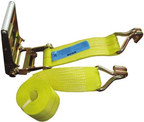
I purchased a tie down strap like the below:
I started at the end that had no hook and cut off enough to wrap under the main support, back over the end of the support, then over to the wall stud. I tacked it into place and set the kayak on it and adjusted until I got the length I wanted. I then took the kayak off, measured the length (for the other end), cut it from the full length, and finally nailed it all in place.
Here are a few other views to get an idea how things went:


I ended up going with the solution that sucked the least. I decided to build some slings that hooked to the side of my garage wall. I made the slings wide enough to lay the kayaks flat instead of on their side to minimize the vertical space I took up. Luckily if this turns out to be the wrong move I can move my supports and straps to improve the situation.
Here is a picture of the first sling with kayak:
That is real pine, you know. No cost spared.
And here is a picture of my trusty cutoff saw:
The main support is 28" long with a 30 degree angle on each end. I put a piece of wood above and below where the main support connected to the wall stud to help with the rotational pressure that would occur at that point. Then I used another pieced of wood to cover all three to provide additional support. I used 2 1/2 inch wood screws to attach everything. Here is a view:
I purchased a tie down strap like the below:
I started at the end that had no hook and cut off enough to wrap under the main support, back over the end of the support, then over to the wall stud. I tacked it into place and set the kayak on it and adjusted until I got the length I wanted. I then took the kayak off, measured the length (for the other end), cut it from the full length, and finally nailed it all in place.
Here are a few other views to get an idea how things went:
Starting mapping efforts of Mad River
My online mapping of the Mad River in and around Dayton OH can be found HERE.
Kayaking The Little Miami River
My kayaking buddy (Mikey C.) and I will be paddling the length of the Little Miami River in Ohio. It’s not a challenging river as far as rapids go but it is local to us and allows us to have something interesting to do. We won’t do it all at once but will break it up into about three weekends. Most likely we will arrive at drop off Saturday morning, paddle all day, camp, then paddle more on Sunday.
I have used several online resources to map out out the route. They are:
http://www4.wittenberg.edu/academics/hfs/tmartin/LittleMiami/LittleMiamiRiver.htm
http://www.thenaturalresource.com/fishing/WATACCRS_05.php (I think this one also pulled from the Wittenberg Map originally)
A link to the map I created, and will continue to update, is HERE
Many miles of the Little Miami River is covered by canoe/kayak rental businesses. This means that the river is fairly cleared of blockage and is generally passable. I don’t mind a few portages but as I’ve never done this river I’d like for it to go as smooth as possible.
My main concern for the trip is camping. I’ve never camped out of a canoe/kayak so I fear I may over or under pack. My other concern is not knowing how far we can realistically paddle in one day. On our Branson trip we went almost 10 miles in smooth water that had no current. It tired us out but we were pushing most of the way. If we had all day I think we could have done several more miles, possible 15? With a small river with current I suspect we will target 15-20 miles on the Saturday, 10 on the Sunday. We will determine ahead of time where we are stopping to camp, and where we are taking out.
I may take a camera to document the trip. I fear getting it wet but I don’t want to accept the photos I get from a disposable.
Monday, August 10, 2009
Branson MO Trip (Aug 3 - Aug 9 2009)
This past week another family and my crew went to Branson MO, for vacation. We stayed South West of the actual city and were very close to Table Rock Lake (http://en.wikipedia.org/wiki/Table_rock_lake) and Lake Taneycomo (http://en.wikipedia.org/wiki/Lake_Taneycomo). Table Rock Lake is a deep lake used for standard boating and fishing by locals and tourists while Lake Taneycomo is mostly for trout fishing in the first 5-8 miles where it meets Table Rock Lake. Due to Lake Taneycomo being fed from the bottom water of Table Rock Lake it is very cold. Cold enough that if you put your hand in the water it won't take long for you to pull it back out. Lake Taneycomo has no current except for when Table Rock Dam releases water to generate electricity. The schedule (which changes constantly) is located here: http://www.swpa.gov/generationschedules.aspx
To see a map of our route and locations referenced, go here: http://www.bing.com/maps/?v=2&encType=1&cid=EEB4527CCD383B86!466
We arrived on Sunday evening and Mike C. and I went for a small paddle on Table Rock Lake to see what it was all about. We floated and enjoyed a few brews before heading back in as it got dark.
The next morning (Monday) we took the "Hatchery to Branson Landing" (see map) route, which turned out to be about 9.5 miles. There was no current that day so it was all paddle powered. Because we didn't have an idea of where we actually were along the route (we only knew "sort of") we kept up a steady pace and by the end my shoulders were very tired. The great thing about paddling Lake Taneycomo in the morning or late evening is the mist. The water is cold and the air is hot so a mist settles very thick. To paddle through that in the morning while the trout fishermen are doing their thing is very calming and surreal.
Over the course of the vacation we were able to get on both lakes with the wives or the kids. One morning we took the boys out early for some fishing on Lake Taneycomo and another day we took the girls out for some paddling on Table Rock. The wives went with us one morning for a misty trip on Taneycomo and another trip in the evening to watch the sun set on Table Rock. Very enjoyable.
I don't know if I want to go back to the city of Branson again, but I sure want to visit Lake Taneycomo at some point in the future.
Go to Moshannonfalls.com for information on canoeing and kayaking in Pennsylvania.
Subscribe to:
Posts (Atom)